项目简介
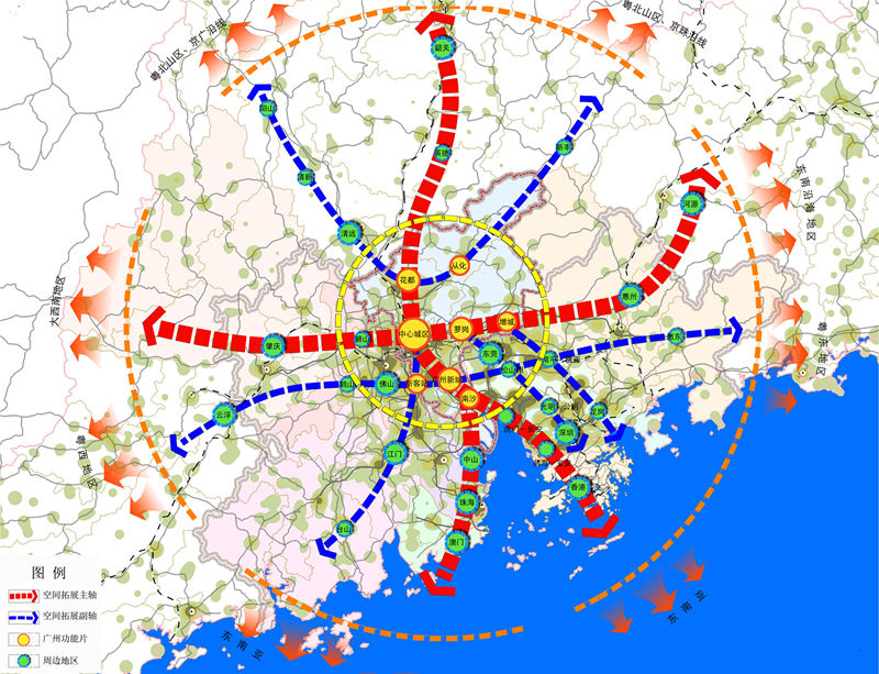
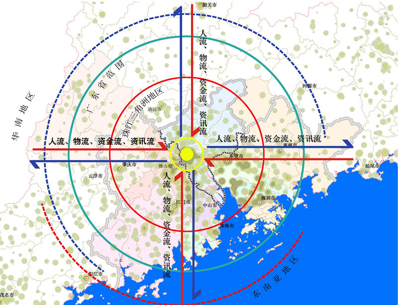
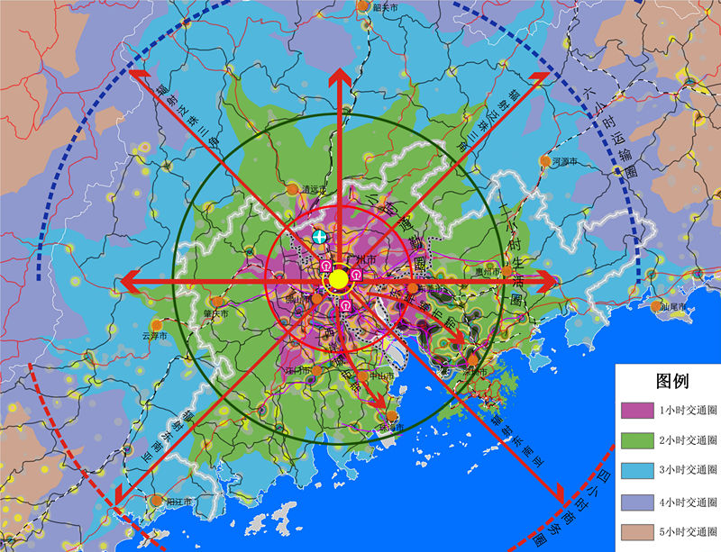
Build a brand-new thinking system, and supported by GIS spatial analysis technology, further determine the city location, spatial layout, space strategy and development strategy based on the accurate interpretation of region function and position of Guangzhou through the analysis of "functional circle, functional area, functional zone, and functional network", with functional analysis as the core, and " region - city - group -region" as the path. It is a new attempt to seek to establish the new technology, new thinking and new framework of overall planning of regional central city. The main features include:
1. "Functional circle" analysis: from the macro perspective (region), using the GIS spatial analysis technology, analyze the scope and intensity of influence of "function circle"-the current and future dominant function of city, and make clear the role and position of city in the region, namely, determining the development orientation of the city.
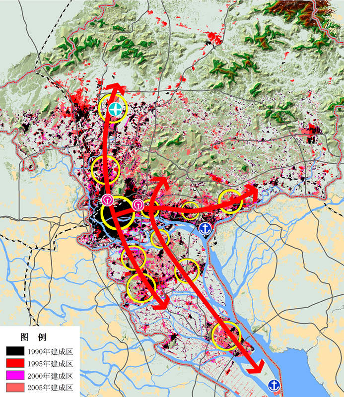
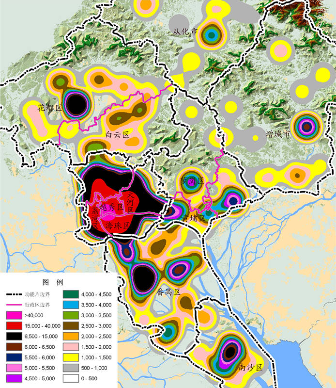
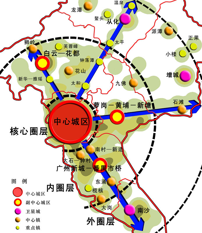
2. "Functional area" analysis: in the meso-level (city area), perform a simulation by using the historical evolution trace of city dominant function determined by GIS technology, and determine the spatial arrangement of each “function area” in the city through the superposition analysis of impact factors.
3. "Functional zone" analysis: from the micro level (city group), analyze the functional grouping of different city zones, and identify the conflict between the old and new functional zones by using GIS spatial analysis technology, so as to determine the development strategy of "functional zone".
4. "Functional network analysis": back to the macro level (region), analyze the functional relationship between "functional zone" and region, build the city-region "functional network" through the analysis of urban and regional gravity model, determine the development correlation degree of different areas within the city and region, and establish the reasonable city development strategy.


